Let's Get Lost is the title of a 1940s jazz song,
famously recorded by singer and trumpeter Chet Baker. Back then, getting
lost was not just a romantic idea but still a realistic one. Today, it's
almost impossible to get lost, no matter how hard you try.
Whether you're haring down the freeway or scrabbling up Mount Everest,
you're always in sight of satellites spinning through space
that can tell you exactly where you are.
Walking round with a smartphone in your pocket, you'll
have ready access to a GPS (Global Positioning System) receiver that
can pinpoint your position, on a good day, to just a few meters. Take a wrong
turn in your car, and a determined voice—also powered by
GPS—will insist you "Take the next left,"
"Turn right," or "Go straight ahead" until you're confidently back on
track. Even riding on a bus or train, it's barely possible to get off
in the wrong place. Handy display boards scroll the name of the
stop you want long before you need to rise from your seat. Apart from
helping us reach our destination, satellite navigation can do
all kinds of other things, from tracking parcels and growing crops to
finding lost children and guiding the blind. But how exactly does it
work? Let's take a closer look!
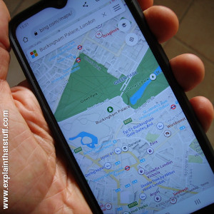
Photo: Getting lost is a thing of the past thanks to mobile devices like this with built-in GPS receivers and mapping apps.
Satellite navigation ("satnav") means using a portable radio
receiver to pick up speed-of-light signals from orbiting satellites
(sometimes technically referred to as space vehicles or SVs) so you
can figure out your position, speed, and local time.
It's generally much more accurate than other forms of navigation, which
have to contend with pesky problems like accurate timekeeping
and bad weather. Because it's a broadcast system based on radio signals
that reach all parts of our planet, any number of people can use it at once, anywhere they happen to be.
The best-known satnav system, the Navstar Global
Positioning System (GPS), uses about 24 active satellites (including backups).
[1]
Day and night, 365 days a year,
they whiz round Earth once every 12 hours on orbital planes inclined at 55 degrees to the equator.
Wherever you are, you're usually in sight of at least half a dozen of them, but
you need signals from only three or four to determine your position
to an accuracy of just a few meters.
GPS was kick-started by the US military in 1973 and its original satellites were designed to last about 4.5 years, but the latest generation are expected to survive four times as long.
[2]
In total, around 60 Navstar satellites have been launched altogether, in three distinct generations and several separate groups called blocks, though many of them have now retired. At the time of writing, the last Navstar launch (the first satellite of a third-generation design) was satellite GPSIII SV06 on
January 18, 2023.
[3]
Photo: A NAVSTAR GPS satellite pictured during construction on Earth in 1981.
You can get an idea how big the satellite is from the engineer pictured some distance beneath it. Picture courtesy of US Department of Defense and
US Air ForceUS National Archives.
GPS has three major components, technically known as "segments": there's one part in space,
one part on the ground, and one part in your pocket.
The 24 satellites form what's known as the "space segment" of GPS, but
the system also relies on an intricate ground-control network of antennas,
monitors, and control stations (the "control segment"),
centered on a Master Control Station (MCS) at Shriever Air Force Base in
Colorado, USA (with a backup at Vandenberg Air Force Base in
California). Apart from the space and control segments, the other essential part of satellite
navigation is the "user segment"—an electronic receiver you hold in your hand or carry in your vehicle.
Photo: GPS as it used to be. In the 21st century, most smartphones have built in GPS receivers and slip easily into a shirt pocket. Back in 1978, this is the kind of cutting-edge GPS equipment you would have needed to do the same thing: a large handheld receiver, a giant backpack, and a very big antenna! Photo courtesy of US Air Force.
Sponsored links
Triangulation
Finding your position using satellite signals is a hi-tech version
of an age-old navigator's trick that goes by the name triangulation.
Suppose you're walking through the woods, on completely flat ground,
but you don't know where you are. If you can see a landmark through
the trees (maybe a distant hill), and you can guess how far away it
is, you can look at a map and figure out that you must be somewhere
on a circle whose radius (distance from the hill) is the distance
you've guessed. One landmark alone can't narrow your position any
more than this. But what if you suddenly see a second landmark in
another direction. Now you can repeat the process: you must be a
certain distance from that object too, somewhere on a second circle.
Put these two bits of information together and you know you must be
somewhere where the two circles meet—one of either two
places on the ground. With a third landmark, you can narrow your
position to a single point. And that's the essence of
simple triangulation (you'll find a longer introduction at
Compass Dude).
Triangulation works with line-of-sight and a bit of guesswork, with a compass and a map, and with fancier methods like radio signals, and radar. And it also works, in a more sophisticated way, using space satellites.
Photo: Sir Francis Drake (c.1540–1596) was the second person to circumnavigate the globe,
finishing in 1580. The first was
Ferdinand Magellan (1480–1521), a Portugese explorer who sailed the globe with great skill and braveness. Between 1519 and 1521, Magellan and his crew became the first to circumnavigate the planet, proving that the "flat Earth" was, in fact, more or less spherical. It's tempting to imagine how much easier Magellan's life would have been with satellite navigation, but that gets the logic of things the wrong way round. Without Magellan's insight, we wouldn't have satellite navigation technology at all: to build it and get it working, we had to know that we lived on a round Earth to begin with!
Trilateration
With satellite navigation, your navigational "landmarks"
are space satellites whizzing through the sky above your head.
Because they're about 20,000km (12,600 miles) away, well beyond Earth's atmosphere,
and because they're constantly moving (not stationary, like Earth-bound landmarks), finding your position
from them is a bit more tricky. If you pick up a signal from one satellite and you know it's
20,000km away, you must be somewhere on a sphere
(not a circle) of radius 20,000km, centered on that satellite. With
two signals, from two different satellites, you must be somewhere
where two spheres meet (somewhere in a circle of overlap). Three
signals puts you at one of two points on that circle—and that's
usually enough to figure out where you are, because one of the points
might be up in the air or in the middle of the ocean. But with four
signals, you know your position precisely. Finding your location this
way is called trilateration.
Photo: An artist's impression of the 24 NAVSTAR satellites in orbit around Earth.
Picture courtesy of US Department of Defense and
Wikimedia Commons.
How GPS works
Satellite navigation systems all work in broadly the same way. There
are three parts: the network of satellites, a control station somewhere
on Earth that manages the satellites, and the receiving device you
carry with you.
Each satellite is constantly beaming out a radio-wave
signal toward Earth. The receiver "listens out" for these signals and,
if it can pick up signals from three or four different satellites, it
can figure out your precise location (including your altitude).
How does that work? The satellites stay in known positions and the
signals travel at the speed of light. Each signal includes information
about the satellite it came from and a time-stamp that says when it
left the satellite. Since the signals are radio waves, they must travel
at the speed of light. By noting when each signal arrives, the receiver
can figure out how long it took to travel and how far it has come—in
other words, how far it is from the sending satellite. With three or
four signals, the receiver can figure out exactly where it is on Earth.
Where in the world are you?
If your satellite receiver picks up a signal from the yellow satellite, you must be somewhere on the yellow sphere.
If you're also picking up signals from the blue and red satellites, you must be at the black dot where the signals from the
three satellites meet.
You need a signal from a minimum of three satellites to fix your position this way
(and four satellites if you want to find your altitude as well). Since there are many more GPS satellites, there's more chance you'll be able to locate yourself wherever on Earth you happen to be.
How do satnavs calculate distance from time?
Suppose you're carrying a GPS-enabled cellphone or satnav
in your car. How does it know the exact distance to the three
or four satellites it uses to compute your position? Every satellite
constantly beams out signals that are, in effect,
time-stamped records of its position at that time.
Since they're carried by radio waves, the signals must be traveling at the speed of light (300,000km or 186,000 miles per second). Theoretically, then, if a receiver picks up the signals some time later, and has a clock of its own, it knows how long the signals have taken to get from the satellite, and how far they've traveled (because distance = speed × time). That sounds like a nice, simple solution, but it introduces two further problems.
First, how long does the signal take to travel? Haven't
we just swapped one problem for another (time for distance)? The
solution to this involves a hi-tech version of "synchronizing
watches": each satellite carries four extremely precise
atomic clocks (two cesium and two rubidium, typically accurate to something like one second in 100,000 years), while the
receivers (which have less accurate clocks of their own) receive their signals and compensate for the time it takes
for them to travel down from space. That means each receiver can figure out how long each signal has taken to reach it and
therefore how far it's traveled.
Second, although radio waves do indeed travel at the speed of
light, they only do so in a vacuum (in completely empty space).
Radio signals beaming down to us from space satellites aren't
traveling through empty space but through Earth's atmosphere, including the ionosphere (the upper region of Earth's
atmosphere, containing charged particles, which help radio waves to
travel) and the troposphere (the turbulent, uncharged region of the
atmosphere, where weather happens, which extends about 50km or 30
miles above Earth's surface). The ionosphere and troposphere distort
and delay satellite signals in quite complex ways, for quite
different reasons that we won't go into here, and GPS receivers have
to compensate to ensure they can make accurate measurements of distance.
Are military and civilian GPS any different?
Photo: Satellite-guided missiles and drones use the military-grade PPS version of GPS, which is theoretically more accurate than civilian GPS. Photo by Nicholas Messina courtesy of
US Navy.
GPS was originally conceived as a military invention that would
give US forces an advantage over other nations, but its inventors
soon realized the system would be just as useful to civilians.
The only trouble was, if civilians (or rival forces) could pick up
the same signals, where would that leave their military advantage?
For that reason, they developed two different "flavors"
of GPS: a highly accurate military-grade, known as Precise
Positioning Service (PPS), and a somewhat degraded civilian version
called Standard Positioning Service (SPS). While PPS-enabled receivers
could originally locate things to an accuracy of about 22m meters (72ft), SPS receivers
were deliberately made about five times less accurate (to within the
length of a football field, or about 100m) using a tweak called Selective Availability (SA).
[4]
That was switched off by order of US President Bill Clinton in May 2000, greatly improving
accuracy for civilian users, which is largely why GPS has taken off so readily ever since.
Even smartphones are now accurate to about 4.9 meters, though a variety
of different errors (caused by the atmosphere, obstructions blocking line of sight to satellites, signal reflections, atmospheric delays, and so on) can compound to make them very much less accurate at times.
[5]
Theoretically, military and civilian GPS could be as accurate as one another if we didn't have to worry about them traveling through Earth's atmosphere. According to the official website
GPS.gov: "The accuracy of the GPS signal in space is actually the same for both the civilian GPS service (SPS) and the military GPS service (PPS)." In practice, while SPS signals are broadcast
using only one frequency, PPS uses two. Comparing the two frequencies allows
military grade GPS receivers to calculate precise corrections for radio
delays and distortions caused by transmission through the atmosphere, and that still gives military GPS an edge over civilian systems. In time, civilian GPS will become increasingly
accurate, especially as more satellites (and more different satellite
systems) are added, but it's likely that military systems will always
have a built-in advantage, for one reason or another.
Having said that, civilian users can sometimes receive more accurate
location information with what are called augmentation systems (Google smartphones, for example,
use Wi-Fi and Bluetooth™ to boost location accuracy).
GPS satellite signals
Navstar satellites constantly broadcast the two different flavors of GPS, PPS and SPS,
on two different radio frequencies (carrier waves) known as L1 (1575.42MHz) and L2 (1227.6MHz).
L1 carries the civilian SPS code signal (also known as the C/A code or Coarse Acquisition code), which is relatively short and broadcast about 1000 times a second, and what's known as the navigation data message, which includes the date and time, satellite orbit details, and other essential data.
L2 carries the military PPS code, also known as P-code (Precision code), which is very long and precise and takes an entire week to transmit. It's encrypted to form what's known as the Y-code, partly so that only authorized users can access it, and partly (because encryption is a form of signing things to confirm they're authentic) to help prevent things like "spoofing" (where third parties broadcast fake, disruptive signals purporting to be from GPS satellites).
Military-grade GPS receivers pick up both frequencies, and compare them to correct for the effects of the ionosphere. Civilian receivers pick up only one frequency and have to use mathematical models to correct for the ionosphere instead.
[6]
Applications of satellite navigation
Most of us use satellite navigation for driving to places we've
never been before—but that's a relatively trivial application. Once
you can pinpoint your precise position on Earth, much more
interesting things become possible. Roll time forward a few
decades to the point where all cars have onboard satnav and can drive
themselves automatically. Theoretically, if a car knows where it
is at all times, and can transmit that information to some sort of
centralized monitoring system, we could solve problems like urban
congestion, finding parking places, and even auto theft at a stroke.
If every car knows its location, and knows where nearby cars are too,
highway driving could become both faster and safer; it will no
longer rely on the vigilance of error-prone human drivers, too easily
confused by tiredness and bad weather, so cars will be able to travel
at much higher densities. The same goes for airplanes, where GPS is
finally set to become an integral part of air traffic
control—gradually reducing our historic overdependence on
radar—over the next decade.
Photo: Many tractors, combine harvesters, and crop dusters are now equipped with GPS.
And it's not just cars and planes that will benefit from pinpoint
precision. For emergency services and search and rescue workers,
navigating to remote, sometimes uncharted locations, in a hurry,
makes all the difference between life and death. Farmers have been
using GPS systems in tractors, combines, and crop-dusters to map,
plant, manage, and harvest their crops with efficiency and precision.
According to an industry body called the GPS Innovation Alliance, high-precision satellite navigation
boosted US crop yields by almost $20 billion from 2007 to 2010 and
is now used in 95 percent of crop dusting.
[7]
Meanwhile, farm animals,
pets, and rare wildlife are easier than ever to track using
GPS-enabled collars and backpacks. Blind people, traditionally guided
by seeing-eye dogs or the elbows of friends and family, can finally
gain true independence equipped with talking handheld GPS systems,
such as Trekker Breeze, that can announce street names or read spoken directions from A to B.
Needless to say, a system conceived by the
military still enjoys many military applications, from guiding
so-called "smart bombs" to their targets with pinpoint accuracy
to helping troops navigate through unfamiliar terrain. GPS is as
standard a part of modern military equipment as maps and compasses
were 100 years ago.
Photo: GPS III Space Vehicle 05 is fired into orbit by a
Falcon 9 space rocket on June 17, 2021. Photo courtesy of US Space Force Public Affairs and DVIDS.
Rival satellite navigation systems
In the United States, GPS is universally used as a synonym for
any and every kind of satellite navigation; in other countries, such
as the UK, "satnav" is a more familiar generic term. In fact, GPS
is only one of several global satnav systems. The Soviet Union
launched a rival system called GLONASS in 1982 (also using 24
satellites) and Russia continues to operate it today.
[8]
Europe has been
slowly building its own, more accurate 30-satellite system called
Galileo, which was expected to be completed in 2023, and
China
completed its 13-satellite BeiDou system in August 2020.
The preferred umbrella term for world-spanning satnav systems is GNSS (Global Navigation
Satellite Systems). Apart from the four big global systems, there are
also smaller regional rivals, including India's seven-satellite
IRNSS.
Although a given satellite receiver is typically designed to use
only one of the global systems, there's no reason why it
can't use signals from two or more at once. Theoretically,
combining signals from GPS, GLONASS, and Galileo could give satnav
devices something like a 10-fold increase in precision, especially in
urban areas where tall buildings can block or distort signals,
reducing the accuracy of any one system used alone. Using multiple
systems also promises to make satellite navigation much faster: if
more satellites are "in view," the so-called Time-to-First-Fix
(TTFF)—the initial delay before your satnav locks onto satellites,
downloads the data it needs, and is ready to start calculating your
position—is reduced. Since TTFF typically varies from about 30
seconds to several minutes, it makes a big difference to casual GPS
users (and is one of the first features people compare when they
look at buying a new satnav receiver).
Challenges and issues
Knowing the absolute position of anything, anytime, anywhere
brings obvious benefits in a globalized world that relies on swift,
safe, and reliable transportation. But it raises issues too. If
civilian transportation systems are designed to rely on
satellite systems provided by the US or Russian military, doesn't
that make us too vulnerable to the sudden twists of international
politics, especially in times of war? Although the US military no
longer routinely degrades the quality of GPS signals, and
announced
in September 2007 that it would be removing Selective Availability
altogether from future versions of GPS satellites, currently it can still nobble
the system anytime it pleases. Could a future world of driverless
cars, hyper-efficient parcel shipping, and automated air-traffic
control be plunged into chaos purely at the whim of the superpowers?
The European Galileo project is entirely a civilian system, which
should eliminate possible military interference in time. But for the
moment, it remains a concern.
Fast-disappearing privacy is the flipside of the same coin. If
your car and your cellphone are both equipped with satnav, and you're
always using one or the other (or both), your movements can be
tracked at all times. That raises obvious privacy issues, especially
in repressive states. But every new technology brings its pros and cons, from internal combustion engines to
submachine guns, and nuclear power plants to antibiotics.
Progress involves making a tradeoff between benefits and costs, in the hope of
doing things better than we ever could before. Satellite navigation is
no different, swapping safe and unreliable navigation for
efficient and effective transportation, albeit at a cost in privacy
and (for the time being) continued dependence on military infrastructure.
Sponsored links
Find out more
On other sites
GPS.gov: The official US Government site all about GPS and its applications.
GPS Innovation Alliance: A trade coalition furthering greater use and new applications of GPS.
Air Force NTS-3 navigation satellite to launch in 2023 by Sandra Erwin, Space News, April 28, 2021. The next innovation in space navigation—the experimental NTS-3
satellite—is slated to head into orbit a year later than planned.
America Has a GPS Problem by Kate Murphy. The New York Times, January 23, 2021.
Does the United States need better GPS backup to guard against interference, jamming, and failure?
Protecting GPS From Spoofers Is Critical to the Future of Navigation by Mark L. Psiaki and Todd E. Humphreys. IEEE Spectrum, July 29, 2016. It's difficult but not impossible to spoof GPS signals, potentially sending ships and boats on course to disaster. What technical methods are there to protect against spoofers?
What Stand-Alone GPS Devices Do That Smartphones Can't by Eric A. Taub. The New York Times, July 15, 2015. There are still good reasons to own a standalone GPS device, although now smartphones have bigger screens the gap between the two kinds of devices is closing fast.
The Global Positioning System: A Shared National Asset by Aeronautics and Space Engineering Board, National Research Council. National Academies Press, 1995. A technical report evaluating the success of GPS and making recommendations for its future development as a joint civilian and military system.
↑ The system is supposed to operate with
24 satellites 95 percent of the time, according to
Space Segment, GPS.gov.
↑ The design life for Block I GPS satellites
was 4.5 years; for Block II, that rose to 7.5 years. Current design life for Block III is
estimated at 15 years, according to
GPS Space Segment, ESA Navipedia.
↑ For an up-to-date list of launches,
see GPS Block III on Wikipedia.
↑Glonass History, Information and Analysis Center for Positioning, Navigation and Timing, Russia.
Please do NOT copy our articles onto blogs and other websites
Articles from this website are registered at the US Copyright Office. Copying or otherwise using registered works without permission, removing this or other copyright notices, and/or infringing related rights could make you liable to severe civil or criminal penalties.